River Map of India
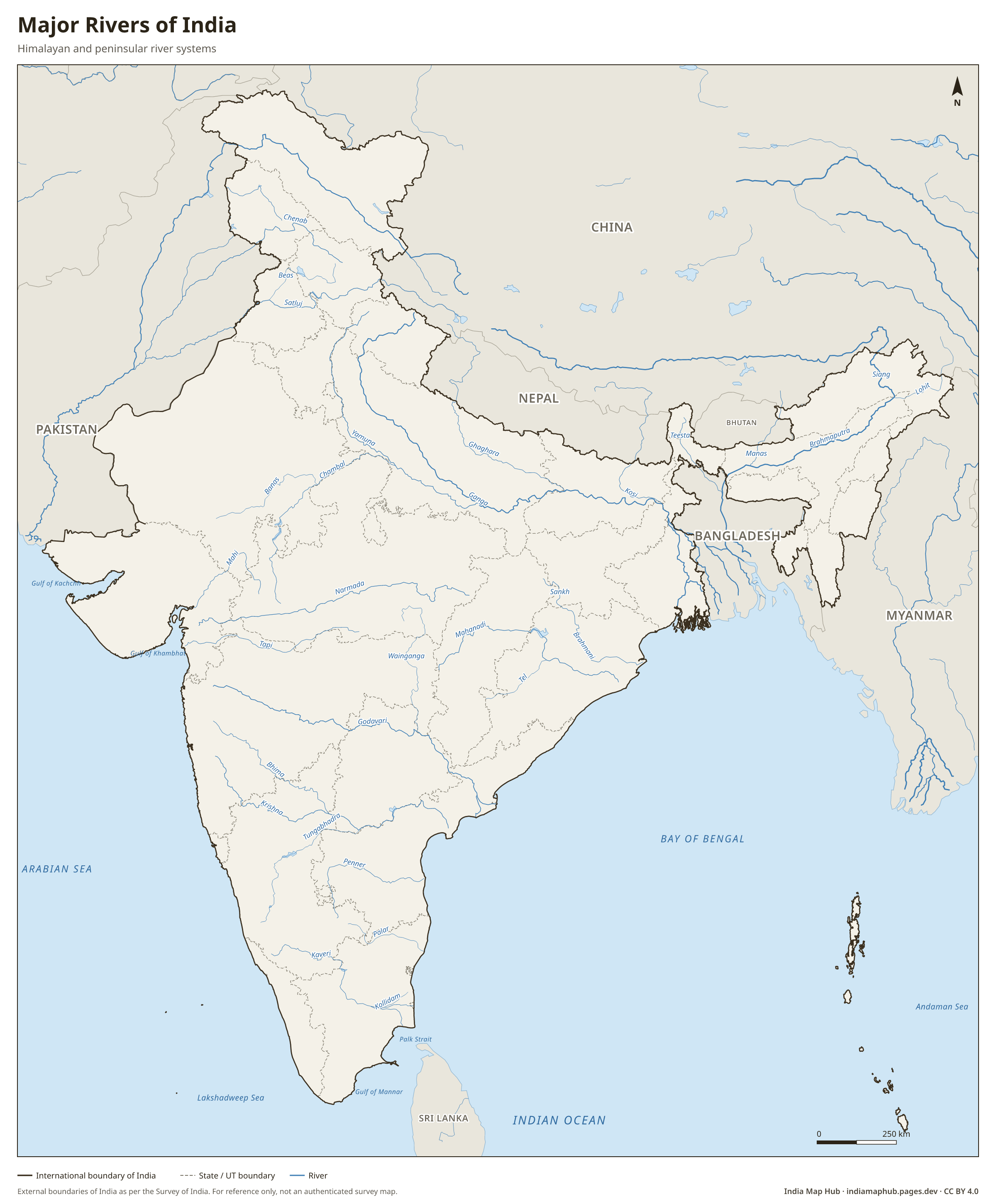
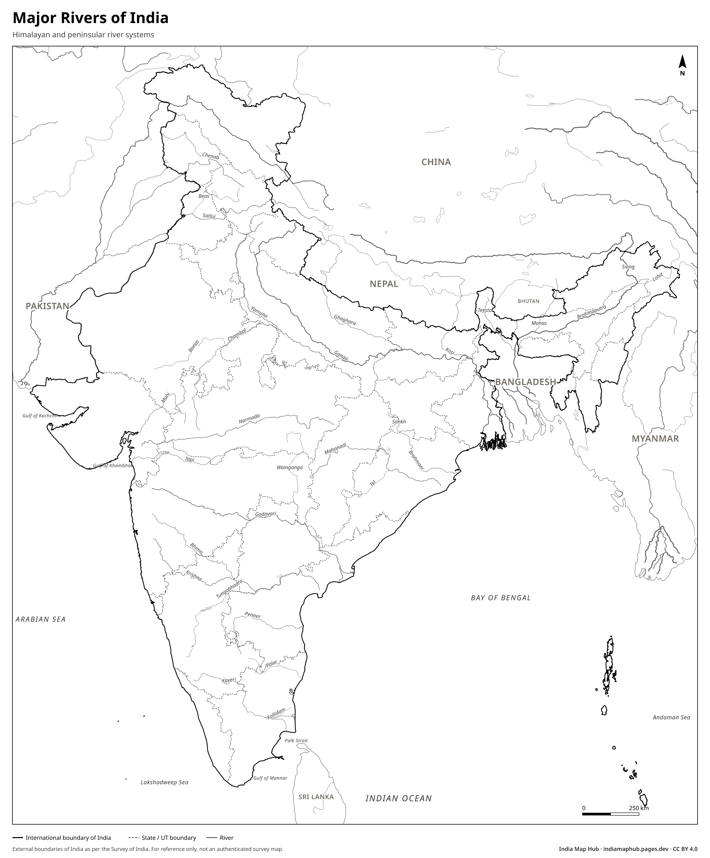
Map of the major rivers of India: Ganga, Yamuna, Brahmaputra, Indus, Godavari, Krishna, Kaveri, Narmada, Tapi, Mahanadi and more. Free HD PNG, PDF and SVG.
 Black & white
About this map
India's rivers fall into two groups. Himalayan rivers such as the Indus, Ganga and Brahmaputra are fed by snow and glaciers and flow all year. Peninsular rivers such as the Godavari, Krishna, Kaveri and Mahanadi depend on monsoon rain.
The Ganga is India's longest river, about 2,525 km. The Godavari, about 1,465 km, is the longest peninsular river and is often called the "Dakshin Ganga". Most peninsular rivers flow east into the Bay of Bengal. The Narmada and Tapi flow west through rift valleys into the Arabian Sea.
How to use this map
- PNG: paste into Word, Google Docs, PowerPoint or Canva. Use the Print size for posters.
- PDF: print on A4 (or scale up to A3). It's a vector file, so it stays sharp.
- SVG: open in Illustrator, Inkscape, Figma or CorelDRAW to change colours, fonts or labels.
Boundaries on this map follow India's official boundary as published by the Survey of India. Read why this matters.
Credit line (copy & paste)
Required when you use this map. Keep it below the map, in your credits or in your references.
Embed on your website or blog
Frequently asked questions
Which is the longest river in India?
The Ganga, about 2,525 km long, flowing from Gangotri in Uttarakhand to the Bay of Bengal.
Which rivers flow west in India?
The Narmada and the Tapi are the main west-flowing rivers. They empty into the Arabian Sea.