
Why many maps show India wrong, and how to find a correct one
If you search for an "India map" or "world map" image online, many of the results don't match the map of India in Indian textbooks and government documents. The difference is mostly at the top of the map, in Jammu & Kashmir and Ladakh, and sometimes in the north-east. This page explains the difference, why it matters, and how to tell whether a map is correct.
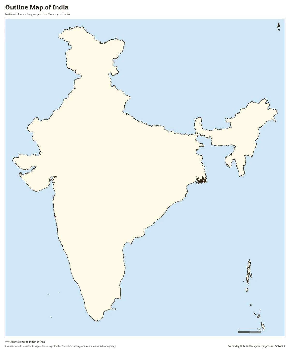
What India's official map shows
The Survey of India publishes the official boundary of India. On it:
- Jammu and Kashmir (union territory) includes the area under Pakistani occupation, often called PoK, including Muzaffarabad and Mirpur.
- Ladakh (union territory) includes Gilgit-Baltistan, the Shaksgam Valley and Aksai Chin.
- Arunachal Pradesh is shown in full, along India's boundary with China.
This gives the official map its familiar shape: a pointed northern tip above Gilgit, and a wide north-eastern bulge in Ladakh that takes in Aksai Chin.
How other maps differ
Many international map makers draw the Line of Control (with Pakistan) and the Line of Actual Control (with China) as the boundary, or show these regions as part of other countries. Some show them as "disputed" with dotted lines. That is why a world map downloaded from a foreign stock-image site or an open data set often shows a "cut" India.
Why it matters if you publish maps in India
- Law. India treats its external boundary seriously. Publishing a map that questions India's territorial integrity can attract action under Indian law (for example, the Criminal Law (Amendment) Act, 1961). Government agencies have also asked publishers and online platforms to correct wrong maps.
- Reputation. Companies, apps and influencers have faced public criticism and forced apologies for using maps with the wrong boundary.
- Education. Students preparing for board exams and competitive exams (UPSC, SSC, state PSCs) need to learn the official boundary.
This page is general information, not legal advice. For official or legal work, use maps published or authenticated by the Survey of India.
How to check whether a map of India is correct
- Look at the very top. The official map has a pointed northern tip reaching about 37°N, above Gilgit.
- Look at Ladakh's north-east. The official map includes Aksai Chin, which gives Ladakh a wide, squarish eastern edge.
- Look at the north-east. All of Arunachal Pradesh should be inside India, up to the McMahon Line.
- Check the west of J&K. Muzaffarabad should be inside India.
Where to get correct maps
Every map on India Map Hub is generated from boundary data aligned with the Survey of India map. Automated checks run before each update and confirm that places such as Gilgit, Muzaffarabad, Aksai Chin, the Shaksgam Valley, Siachen and Tawang fall inside India. The maps are free to use with a credit line.
India political map · India outline map · World map with correct India · India on world map